The following questions are based on Map T-10, the “Furnace Creek, California” quadrangle (scale 1:62,500; contour interval 80 feet; dotted lines represent 20-foot contours).
1. Using the graph at right, construct a topographic profile from Point A in the Panamint Range to Point B on the basin floor. Plot the index contours and any other contours needed to show key features along the profile.
2. On the topographic profile, label (a) the basin floor, (b) the alluvial fan, and (c) the mountain front.
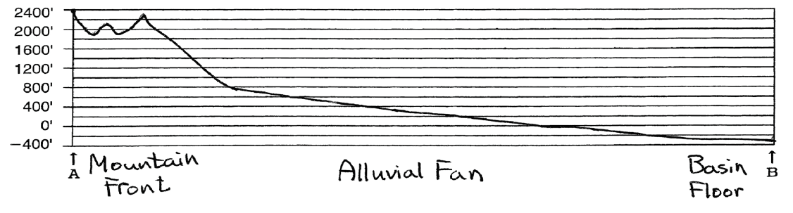
Topographic profile for line AB on the “Furnace Creek, California” quadrangle. Vertical exaggeration of the profile approximately 2.6x.
You might also like to view...
On an H-R diagram, where do stars spend most of their life span?
What will be an ideal response?
These volcanoes are the most likely to explode violently.
A. Shield volcanoes B. Stratovolcanoes C. Cinder cones
Atmospheric temperatures are influenced by all of the following greenhouse gases EXCEPT
A. water vapor. B. nitrogen. C. methane. D. nitrous oxides.
What percentage of the rocks exposed on the continents originated as sedimentary rocks deposited in ancient ocean environments?
A) Less than twenty percent B) Twenty to thirty percent C) Thirty to forty percent D) Forty to fifty percent E) More than fifty percent