Briefly contrast the general topography in the northern third of the map, with the topography in the southern two-thirds of the map. What might explain these differences?
The following questions are based on Map T-9, the “Park City, Kentucky” quadrangle (scale 1:24,000; contour interval 10 feet) and Figure 44-3, a stereogram of the same area (37°05'03"N, 86°05'27"W). The boundary of Mammoth Cave National Park is just beyond the northern margin of the map. The surface shown in the southern two-thirds of the map is predominantly limestone, whereas in much of the northern third, a layer of sandstone caps the limestone.
What will be an ideal response?
Very irregular with many sinkholes in the south; higher relief with fewer sinkholes in the north. Different exposed surface rock.
You might also like to view...
How would you describe light generated by heating pure elements if it was observed through a prism or spectroscope?
A. You would see a rainbow of colors. B. You would see one line of emitted light, but it would be different for each element. C. You would see a series of very sharp lines of emitted light. D. Light is absorbed by heated elements so you would not see anything. E. none of the above
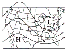
Surface Map

A. cP B. cT C. mP D. mT
In what two countries have nuclear power accidents had the greatest effect on people's attitudes towards safety?
A. United States and Japan B. Poland and UK C. Russia and UK D. South Africa and US
How did the 1815 eruption of Tambora have global implications for climate change? Was this temporary or permanent?
What will be an ideal response?