In classifying the climate of this imaginary country, the hottest and driest areas are in the
Colors on this map of an imaginary country represent mean annual temperatures (reds above 28 degrees Celsius, blue and purple below 0 degrees Celsius).
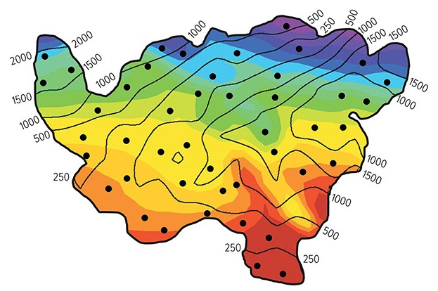
A) northeast.
B) southeast.
C) southwest.
D) northwest.
B) southeast.
You might also like to view...
All of the following are suggestions by Lester Brown and Paul Hawken for making a transition to more environmentally sustainable economies except
a. mimic nature b. reduce poverty c. sell more things instead of services d. use full-cost pricing e. use eco-labels on products
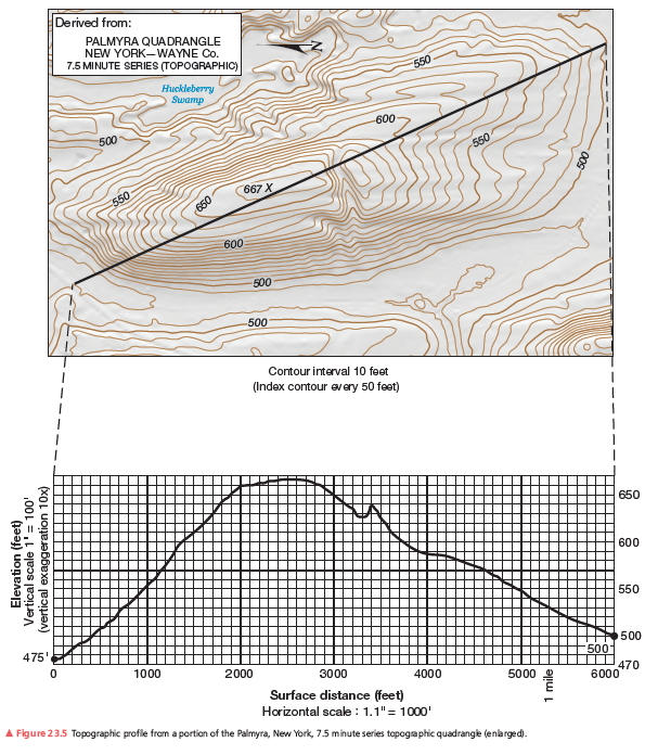
What is the horizontal distance of this topographic profile?
Use the profile constructed in Figure 23.5 to answer the question and completion items.
What will be an ideal response?
What does the Coriolis effect do?
What will be an ideal response?
Shortening or folding of the crust is produced by strain caused by tension
Indicate whether the statement is true or false