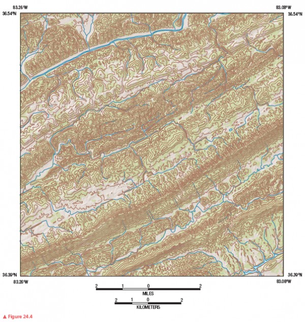
Which type of drainage pattern is shown in Figure 24.4? Briefly describe the structural conditions that have created this pattern.

Figure 24.4
The trellis drainage pattern is characteristic of dipping or folded topography, which exists in the nearly parallel Ridge and Valley Province of the eastern United States, where drainage patterns are influenced by rock structures of variable resistance and folded strata.
You might also like to view...
List and describe the stages of development of an ordinary thunderstorm. About how long does a single ordinary thunderstorm cell last?
What will be an ideal response?
As waves enter the coastal zone, wavelengths shorten and wave heights increase
Indicate whether the statement is true or false
The shift from using wood as a source of fuel to coal was caused by
A. the start of World War I. B. a decline in local supplies of wood. C. a decrease in coal prices. D. an increase in wood prices.
How are silt deposits called loess related to glaciers?
A. They are wind-blown accumulations and commonly are derived from glaciers. B. They form in lakes as the lakes dried up at the end of the ice ages. C. They were deposited by large glacially caused floods in the Pacific Northwest. D. They accumulate in lakes trapped behind glaciers.