Where is the highest elevation shown in this landscape? (It may not be a location marked with a letter.)
The question is based on this contour line map with elevations shown in feet.
• North is to the top of the map.
• Streams are shown with dashed lines.
• A graphic scale for measuring horizontal distances is shown below the map.
• Estimate elevations between contour lines to the nearest half-contour interval; assume that the top of a
hill is one-half-contour interval higher than the highest contour line shown.
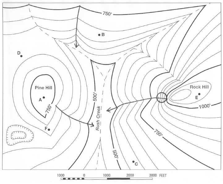
What will be an ideal response?
Rock Hill
You might also like to view...
Which of the following contracts most when the temperature is increased? Equal volumes of
A) iron. B) wood. C) ice water. D) helium. E) None of these contract when heated.
Which worldview is based on a belief that the best way to manage the planet for human benefit involves minimal government interference and regulation?
A. no-problem school B. free-market school C. spaceship-earth school D. stewardship E. ecocentrism
All of the following countries are in the North American region EXCEPT
a. United States. b. Canada. c. Greenland. d. Mexico.
The Mercator map is actually a ____ type of projection that has been mathematically derived
a. conical b. cylindrical c. planar d. interrupted