Which of the following is an example of intraplate volcanism?
A) Mount St. Helens
B) Deccan Traps
C) East African Rift system
D) Iceland
Answer: B
You might also like to view...
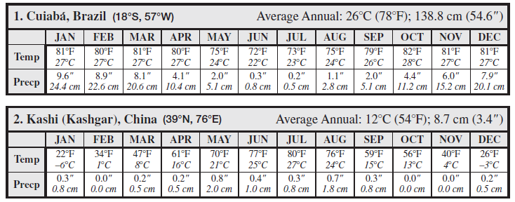
Answer the following questions about Kashi (Kashgar), China location using the climographs.
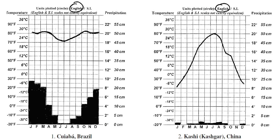
(a) Köppen climate type: Letter code: ___________________
Descriptive name: _______________________________
(b) Dominant climate controls for this location:
Estimate the minimum thickness of the ice at the terminal moraine in the area of Blue Spring Lake. Assume that the ice extended up at least to the highest point on the moraine. (Determine the thickness of the ice, not its elevation.)
The question is based on Map T-11, the “Whitewater, Wisconsin” quadrangle (scale 1:62,500; contour interval 20 feet; dotted lines represent 10-foot contours). The irregular high ground of “Kettle Moraine State Forest,” running diagonally from the lower left to the right center of the map, is a terminal moraine left by a Pleistocene ice sheet (42°51'34"N, 88°35'59"W). The region northwest of the terminal moraine was once covered by the ice. The region in the southeast corner of the map is the edge of the glacial outwash plain. What will be an ideal response?
Tectonic plates move in response to ____
a. convection cells in the mantle b. convection cells in the core c. subduction cells in the mantle d. subduction cells in the core
The origins of GIS is generally traced to Dr. Snow in 1854, who overlaid three different maps to identify the source of the cholera outbreak in London
Indicate whether the statement is true or false.