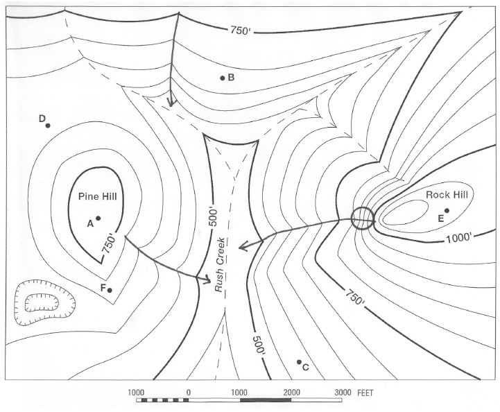
What is the elevation at the bottom of the depression southwest of Pine Hill?
The question is based on this contour line map with elevations shown in feet.
• North is to the top of the map.
• Streams are shown with dashed lines.
• A graphic scale for measuring horizontal distances is shown below the map.
• Estimate elevations between contour lines to the nearest half-contour interval; assume that the top of a
hill is one-half-contour interval higher than the highest contour line shown.

What will be an ideal response?
525 feet
You might also like to view...
Determining specific, quantitative dates for rock units or events expressed in years before the present is known as
____ dating. a. relative b. absolute c. sedimentary d. correlative e. blind
Explain the types of landscape features formed by valley-glacier erosion
What will be an ideal response?
The presence of grabens and horsts indicates the occurrence of
A) volcanic activity. B) rift activity. C) collision activity. D) strike-slip activity.
What process is responsible for transforming the Earth from having a homogeneous interior to a layered one?
a) Chemical differentiation b) Chemical refraction c) magmatism d) metamorphism e) volcanism