What is the highest elevation shown in this part of the Panamint Range?
The question is based on Map T-10, the “Furnace Creek, California” quadrangle (scale 1:62,500; contour interval 80 feet; dotted lines represent 20-foot contours). This portion of the Furnace Creek quadrangle shows the Panamint Range and the western side of Death Valley in Death Valley National Park (36°19'08"N, 116°53'25"W). Several large alluvial fans can be seen along the eastern front of the Panamint Range. The basin floor here is called the Death Valley “salt pan,” because salts have accumulated here in great thicknesses.
What will be an ideal response?
4889 feet
You might also like to view...
Which of the following regions has the highest population density?
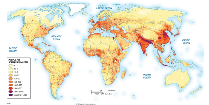
A) South Asia
B) Australia
C) Russia
D) Africa
E) North America
North America and Europe account for nearly three-fourths of the world's
A) oil production. B) energy consumption. C) population. D) coal production.
Which of the following includes volunteer work and damage from pollution in a country's goods and services?
A) GPI B) GNP C) GDP D) ATP E) GAP
The point on Earth's orbit around the Sun when the two bodies are farthest apart is called ____
a. perihelion b. aphelion c. ecliptic d. equinox e. solstice