Although both are coastal cities, compared to Oakland, Norfolk has a very “continental” temperature pattern. Why?
Six charts showing the average monthly temperature (in °C and °F) for seven U.S. cities are provided (the first letter of each month of the year is shown along the bottom of the charts). For each of the cities, the latitude and longitude, as well as the elevation, are provided.
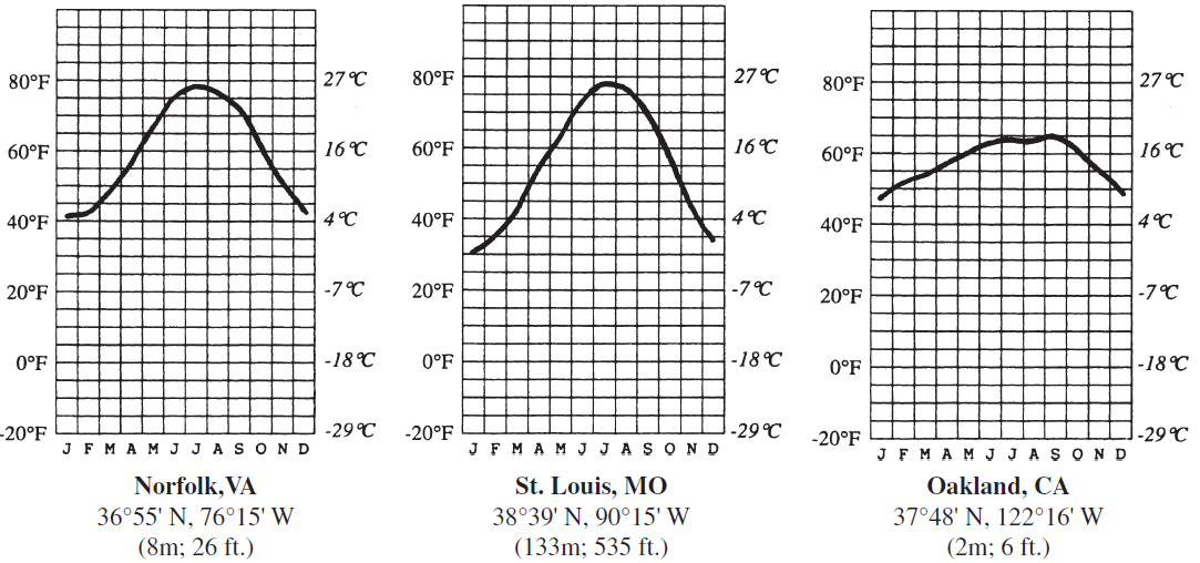
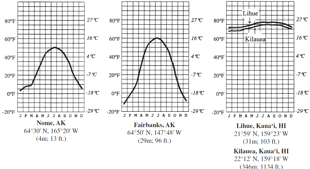
Answer the question by comparing the temperature charts. In your answers, consider the one temperature control factor that is most responsible for the patterns shown (choose from latitude, land–water contrasts, wind patterns, or altitude). You may use the same answer for more than one question. You should locate each of the cities on a world map before trying to answer the question. If altitude is the main factor cited, calculate the expected temperature difference between the two cities based on the average lapse rate.
Wind patterns: Westerlies bring continental air masses across continent to east coast.
You might also like to view...
When an electron passes through the magnetic field of a horseshoe magnet its
A. direction of motion is changed. B. speed is increased. C. both of these D. none of the above
If the dry-bulb temperature is 55°F and the wet-bulb temperature is 52°F, What is the mixing ratio?
Using the psychrometer tables and the table of saturation mixing ratios, answer the question about determining relative humidity with a sling psychrometer. What will be an ideal response? __________ g/kg
Banded iron formations consist of alternating layers of iron minerals and chert. Indicate whether the statement is true or false
The principal factors in the formation of photochemical smog are high concentrations of nitrogen oxides and
A. reduced precipitation. B. high levels of carbon monoxide. C. high relative humidity. D. strong sunlight.