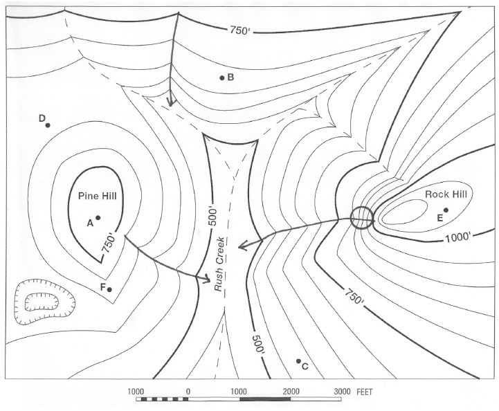
Is it possible to see D from F?
The question is based on this contour line map with elevations shown in feet.
• North is to the top of the map.
• Streams are shown with dashed lines.
• A graphic scale for measuring horizontal distances is shown below the map.
• Estimate elevations between contour lines to the nearest half-contour interval; assume that the top of a
hill is one-half-contour interval higher than the highest contour line shown.
What will be an ideal response?
No
You might also like to view...
The type of rock shown in this photograph is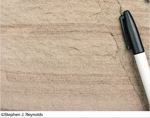
A. sandstone. B. breccia. C. conglomerate. D. shale.
Describe or draw and label the stages of development of an oxbow lake, from meander bend to cut off to oxbow lake, including the location of cut banks and point bars
What will be an ideal response?
At the beginning of each World War, the U.S. was reluctant to become involved and practiced the policy of __________
Fill in the blank(s) with correct word
The water-balance methodology is, in essence, an accounting or bookkeeping system for water resource analysis
Indicate whether the statement is true or false