Describe the evidence for this that you see in the photographs or map.
The questions on the following page are based on Figure 45-4, a stereogram of the Stovepipe Wells region of Death Valley, California, Figure 45-5, a portion of the “Stovepipe Wells, California” quadrangle (scale 1:62,500; contour interval 80 feet; north is to the left side of the stereogram and topographic map), and Map T-27a, color aerial imagery of this same region of Death Valley. Several large alluvial fans that come out of the Tucki Mountains are coalescing to form a bajada 136°35'17"N, 117°06'35"W).
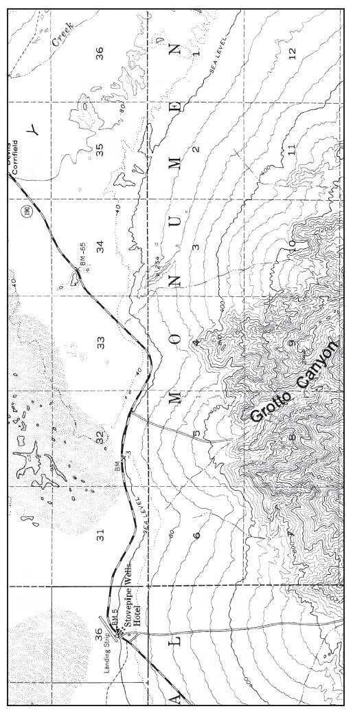
Figure 45-5: USGS “Stovepipe Wells, California” quadrangle. North is to the left side of the page (scale 1:62,500; contour interval 80 feet, dotted lines represent half-interval contours<--N).
Channels have been cut down into the tops of most fans and at the mouths of canyons; desert varnish has been eroded away along some of the channels as well.
You might also like to view...
Discuss what volcanologists look for in trying to determine if a volcano is about to erupt. What will be an ideal response?
The horizontal distance between two successive wave crests is:
A piece of gravel in a stream is least likely to experience which motion?
A) sliding along the floor B) bouncing along the floor C) whirling in an eddy D) rolling along the floor
Which school of economics considers natural capital to be important but not indispensable?
A. classical B. neoclassical C. capitalistic D. ecological E. socialistic