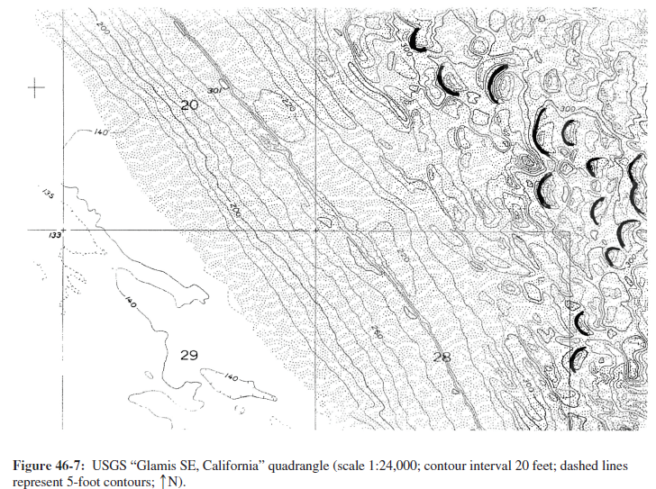
What is the prevailing wind direction in this area?
The question is based on the “Glamis SE, California” quadrangle shown below (Figure 46-7); a stereogram of the same area is shown in Figure 46-3. The map shows a region of mostly transverse sand dunes in southeastern California (32°50'46"N, 115°00'21"W). Note that many depression contours are used on this map, but they are difficult to read because of the sand stippling. To view this map in color, go to the Lab Manual website or scan the QR code for this exercise.

What will be an ideal response?
From west-northwest to east-southeast
You might also like to view...
Under which of the following conditions do hurricanes dissipate?
A. when they move over land B. when upper-level outflow of air exceeds surface inflow of air C. when they move over warm water D. when they move into a region of weak vertical wind shear
When the elevation of the water table is higher than the level of the surface of a stream, you have a __________.
a.) dry stream b.) losing stream c.) flooding stream d.) gaining stream
The horizontal pressure gradient shown in the figure requires that [INSERT FIGURE 4-9. INCLUDE ALL TEXT. NO CAPTION]
A) the height of a particular pressure level must remain constant B) the height of a particular pressure level must increase in the direction of colder air C) the height of a particular pressure level must increase in the direction of warmer air D) the height of a particular pressure level must decrease in the direction of warmer air
Areas such as the San Joaquin Valley and Mexico City have experienced subsidence because ____.
A. of a drought that lasted decades B. the sediments were all clay C. groundwater was overpumped D. of urban growth that made the area sink E. the main rivers were dammed