If you were helping to plan the painting of a world map on a local school playground that is approximately 10 meters along the equator, what scale would be best?
RF: _________________________
Written scale: _________________________
RF: 1:407,500
Written scale: 1 cm = 4.075 km
You might also like to view...
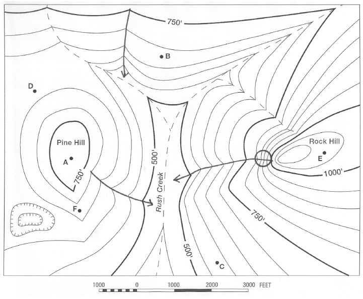
In which direction does Rush Creek flow?
The question is based on this contour line map with elevations shown in feet.
• North is to the top of the map.
• Streams are shown with dashed lines.
• A graphic scale for measuring horizontal distances is shown below the map.
• Estimate elevations between contour lines to the nearest half-contour interval; assume that the top of a
hill is one-half-contour interval higher than the highest contour line shown.
What will be an ideal response?
There are less than 500 species of fish, crustacean, and mollusks that are regularly harvested from the ocean
Indicate whether the statement is true or false
Time divisions in the Precambrian are based on ____
A)distinct fossil assemblages B)metamorphic assemblages C)absolute dates D)time-stratigraphic units E)igneous assemblages
The general pattern of layered changes in soil with depth is called ______________
Fill in the blank(s) with correct word