What type of geographic feature is the water body called Fish Lake, and how did it form? Use the illustration in Figure 24.3 to identify this water feature.
Figure 24.8 is a portion of the Philipp, Mississippi, 7.5-minute quadrangle in northwestern Mississippi. The Tallahatchie River flows through the landscape from west to east. (Remember to use the topographic map symbol legend inside the front cover of this manual.)
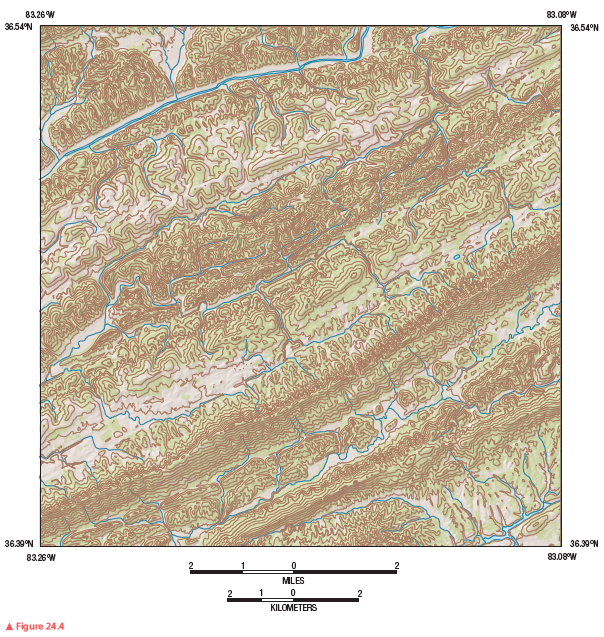
Review Figure 24.4, analyze Figure 24.8 closely, and answer the following questions and completion items about Figure 24.8.
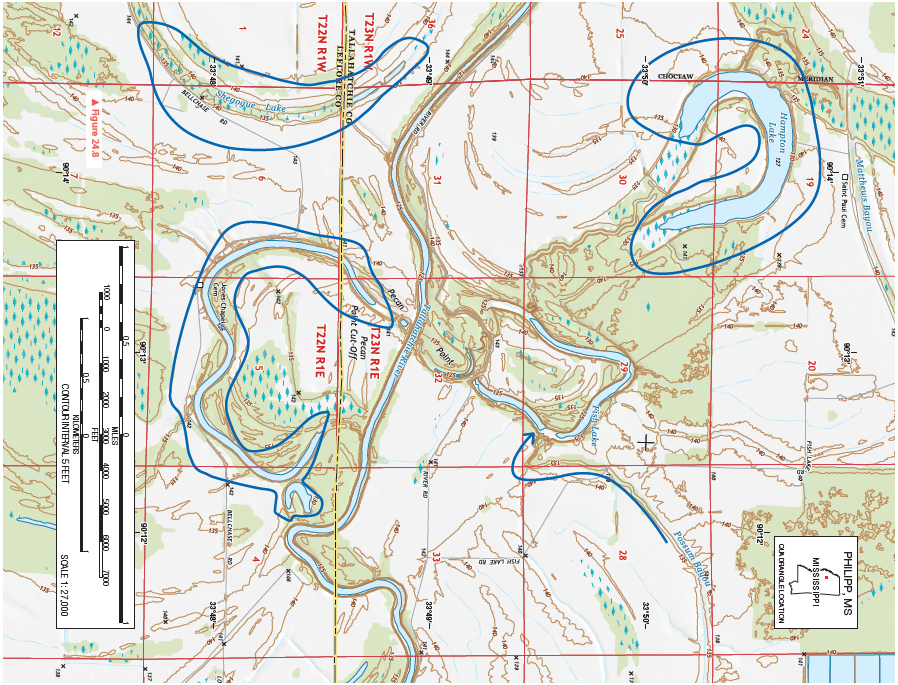
It is an oxbow lake. it was formed when the river cut through a meander bend and the old channel was filled in with sediment due to lower velocity.
You might also like to view...
What is the relief from Allegany High School to the highest point along the profile (south of the water gap)?
What will be an ideal response?
Which of the following amino acids has the lowest pI?
A) arginine B) cysteine C) glycine D) glutamic acid
The half-life of I-131 is 8.0 days. If a medical treatment involves a dose of 100. mg of I-131, how much of the isotope remains after 16 days?
A) 12.5 mg B) 25.0 mg C) 50.0 mg D) 75.0 mg
Which of the following is considered an "underdeveloped" country?
A) Australia B) Germany C) Japan D) United States E) none of the above