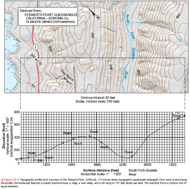
After you complete the topographic profile you’ll notice a marine terrace, a relatively flat platform or “shelf,” along the coast. You can find where the marine terrace ends by looking along the topographic profile for where the slope changes from flat to steeper. What contour elevation marks this change from the marine terrace to the hills inland? How wide is this terrace from the coast line to that contour line elevation in feet?
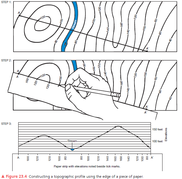
A second example of a vertical profile is in Figure 23.6. Using the same procedure as you did on the previous assignment, construct a topographic profile. Label the South Fork of the Gualala River (see Figure 23.4, Step 3), the bench mark at 112 feet, and various road crossings on your profile. The coastline forms a contour line of equal elevation—sea level. Note the change in contour interval and scale from that of Figure 23.5. Use Figure 23.6 to answer further questions about preparing a topographic profile.
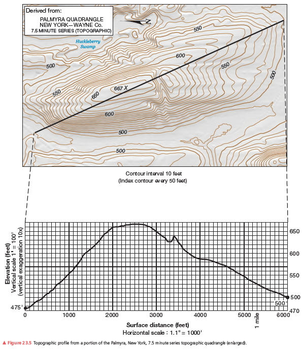
2640 ft (0.5 mi, 0.8 km),
You might also like to view...
What is the reason that the presence of Glossopteris flora fossils was strong evidence for the existence
of Gondwana? What will be an ideal response?
________ gases are responsible for both ozone depletion and greenhouse warming
Fill in the blank(s) with correct word
The first genetically modified animal for human consumption is a salmon with extra growth hormones. Which of the following is NOT a concern about this animal?
A. They will probably outcompete wild salmon for habitat. B. They will probably outcompete wild salmon for mates. C. They will probably outcompete wild salmon for food. D. Eating this fish will add extra hormones into our diet. E. These are all worries about the GM salmon.
An island connected to the coastline by a sandy spit is a relatively rare occurrence called a ________
A) baymouth bar B) tombolo C) fjord D) hook E) lagoon