Locate the large triangle-shaped hill in the bajada, about 3 inches (8 cm) down from the top of the stereogram. Does it appear that alluvium brought down from the mountains is building up and flowing around this hill? How can you tell?
The questions on the following page are based on Figure 45-4, a stereogram of the Stovepipe Wells region of Death Valley, California, Figure 45-5, a portion of the “Stovepipe Wells, California” quadrangle (scale 1:62,500; contour interval 80 feet; north is to the left side of the stereogram and topographic map), and Map T-27a, color aerial imagery of this same region of Death Valley. Several large alluvial fans that come out of the Tucki Mountains are coalescing to form a bajada 136°35'17"N, 117°06'35"W).
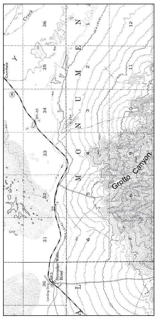
Figure 45-5: USGS “Stovepipe Wells, California” quadrangle. North is to the left side of the page (scale 1:62,500; contour interval 80 feet, dotted lines represent half-interval contours<--N).
Yes, Alluvium is building up from both sides at the bottom of the hill.
You might also like to view...
Climate scientists are deeply concerned about tipping points. What are tipping points and why should we avoid crossing them? Provide two examples of tipping points and explain why they are dangerous.
What will be an ideal response?
The precautionary principle states that we should make decisions that help to prevent a problem from occurring or becoming worse even if we lack conclusive evidence that these outcomes will occur.
Answer the following statement true (T) or false (F)
To reduce the potential for erosion, the safest place for a home by a river is
A) on the inside of a meander. B) on the outside of a meander. C) on a channel island. D) on sand.
Why is it unlikely that geothermal plants will provide a significant amount of electricity in the United States in the foreseeable future?
What will be an ideal response?