An orbiting satellite provides data for analysis by
A) GIS.
B) cartography.
C) projection.
D) remote sensing.
Answer: D
You might also like to view...
What is the horizontal distance of this topographic profile?
Use the profile constructed in Figure 23.5 to answer the question and completion items.
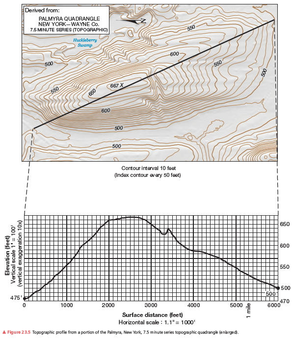
What will be an ideal response?
What is the pattern of discharge shown by this hydrograph?
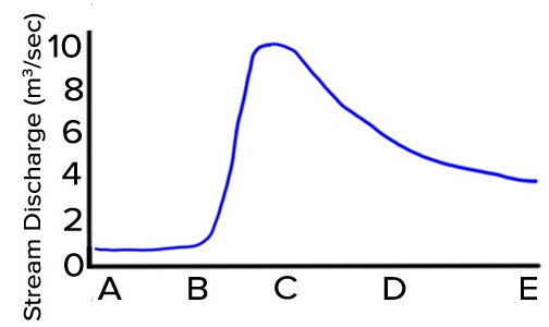
A) Discharge gradually increases and quickly decreases.
B) Discharge quickly increases and gradually decreases.
C) Discharge gradually decreases and quickly increases.
D) Discharges quickly decreases and gradually increases.
Sophisticated climate models forecast a moderate warming of ________
A) high northern latitudes B) low northern latitudes C) low southern latitudes D) middle latitudes E) tropical latitudes
The number of naturally occurring chemical elements is approximately
A. 36. B. 90. C. 200. D. 106.