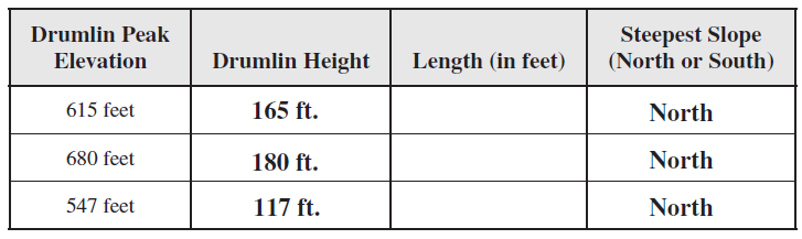
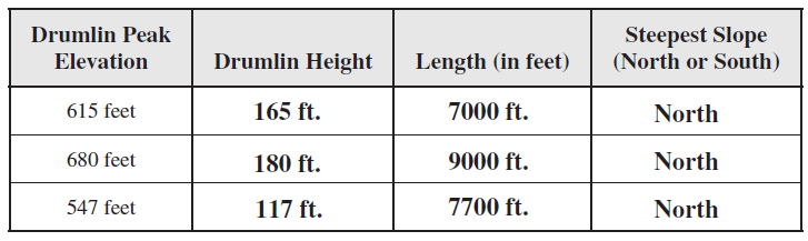
Compare the dimensions of three of the drumlins on the map, identified below by their peak elevation marked with an x. These drumlins are found from bottom center to upper right on the map. “Drumlin Height” refers to the relief of the drumlin, not its elevation. Estimate the “length” of the drumlins from north to south (a graphic map scale is found inside the front cover of the Lab Manual). Finally, note whether the north-facing or southfacing side of the drumlin has the steepest slope.
The question is based on Map T-12, the “Sodus, New York” quadrangle (scale 1:24,000; contour interval 10 feet) and Figure 47-3, a stereogram of this same area (43°09'55"N, 77°04'51"W). The map and stereogram show a number of drumlins, each with its long axis oriented approximately north-south.
You might also like to view...
An igneous rock that contains vesicles ____________
a) is also extrusive b) is also fine grained c) contains many small holes d) all of the above e) none of the above
What percentage of its energy needs does the United States import each year?
A) more than 90 percent B) about 70 percent C) about 50 percent D) about 33 percent E) about 20 percent
Which biome is characterized by tree frogs, large vines, and fruit-eating birds and bats?
A. grassland B. tropical rainforest C. savanna D. tundra
A wind shift from the east to north, to west, would be a:
a. backing wind shift. b. veering wind shift. c. frontal wind shift. d. cyclonic wind shift.