The first airborne platform for aerial photography was a(n)________
A) balloon
B) airplane
C) satellite
D) bird
E) kite
Answer: A
You might also like to view...
The part of the world that has been warming fastest in the last 50 years is ____.
A. the mid-latitudes B. the Arctic region C. North America D. the Tibetan Plateau E. the oceans throughout the world
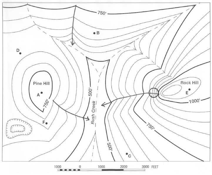
What is the elevation of Point C?
The question is based on this contour line map with elevations shown in feet.
• North is to the top of the map.
• Streams are shown with dashed lines.
• A graphic scale for measuring horizontal distances is shown below the map.
• Estimate elevations between contour lines to the nearest half-contour interval; assume that the top of a
hill is one-half-contour interval higher than the highest contour line shown.

What will be an ideal response?
What is the approximate width of the Souris River channel?
The following questions are based on Map T-4, a portion of the “Voltaire, North Dakota” quadrangle (scale 1:24,000; contour interval 5 feet) and Figure 40-4, a stereogram of the same region showing the Souris River (48°06'23"N, 100°48'05"W). What will be an ideal response?
Evaluate the pros and cons of melting Arctic ice
What will be an ideal response?