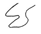
Sketch the current river course.
The following questions are based on Map T-4, a portion of the “Voltaire, North Dakota” quadrangle (scale 1:24,000; contour interval 5 feet) and Figure 40-4, a stereogram of the same region showing the Souris River (48°06'23"N, 100°48'05"W).
What will be an ideal response?

You might also like to view...
Earth's atmospheric pressure always ____________________ with increasing height
Fill in the blank(s) with correct word
The congressional districts of Iowa display
A) "wasted vote" gerrymandering. B) no gerrymandering. C) "stacked vote" gerrymandering. D) "excess vote" gerrymandering.
Ninety eight percent of marine species belong to which of the following?
A) Benthos B) Fungi C) Nekton D) Plankton E) Plantae
The steepest beaches tend to be those with ________
A) the saltiest waves B) no significant waves C) sand D) particles larger than sand E) shorelines facing the Equator