Satellites are used to map the ocean floor because ________
A) they are affected by surface weather
B) they can't cover areas where ships have not produced surveys
C) they can only "see" small areas of the seafloor at one time
D) the shape of the ocean surface reflects large features on the seafloor
E) they are inexpensive to build and launch
D
You might also like to view...
In the diagram below, the most likely place where sediment will be deposited on the streambed is at
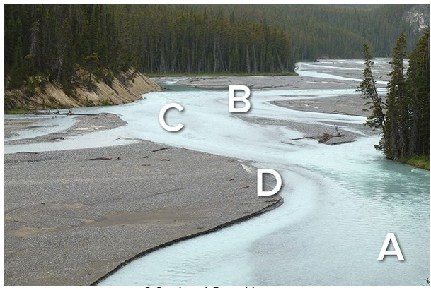
A) A.
B) B.
C) C.
D) D.
Compared to a glass of ice water with ice in it, a glass of plain ice-cold water without ice on a warm day will warm up
A) faster. B) slower. C) in the same amount of time.
Which of the following is not one of the levels of the Linnaean Classification Scheme?
a. phylum d. kingdom b. order e. cohort c. species
Hurricanes are also known as:
a. bagyos. b. cyclones. c. typhoons. d. all of these