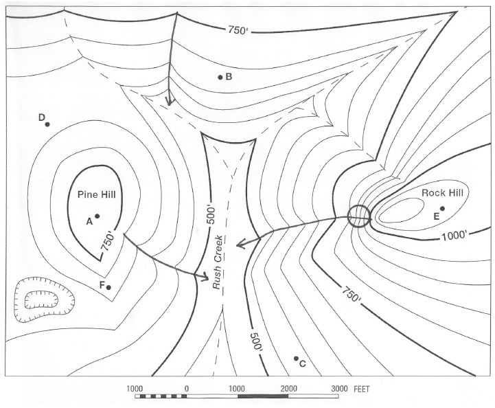
What is the elevation of Point B?
The question is based on this contour line map with elevations shown in feet.
• North is to the top of the map.
• Streams are shown with dashed lines.
• A graphic scale for measuring horizontal distances is shown below the map.
• Estimate elevations between contour lines to the nearest half-contour interval; assume that the top of a
hill is one-half-contour interval higher than the highest contour line shown.

What will be an ideal response?
675 feet
You might also like to view...
The world population is estimated to grow to what size by 2050?
A) over 2 trillion B) 7.4 billion C) 9.8 billion D) 200 billion E) 700 million
The special geologic terms used to represent the direction of a horizontal line on an inclined surface (like in a fault) is
A) dip. B) joint. C) hanging. D) horst.
Which of the following is a mathematical statement of Boyle's Law?
A) P1/V2 = P2/V1 B) P1/V1 = P2/V2 C) P1/T2 = P2/T1 D) P1/T1 = P2/T2
The mass of a population of fish present at a given time is called its ________
A) diversity B) fish stock C) maximum sustainable yield D) recruitment mass E) standing stock