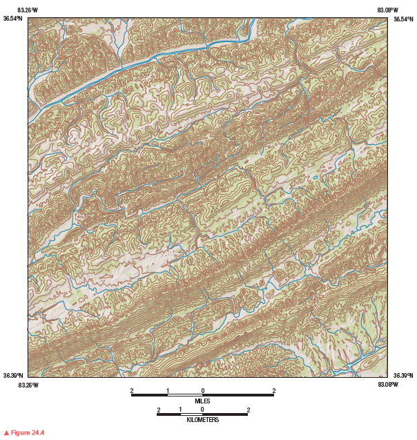
What is the contour interval on this map segment?
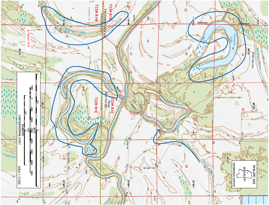
Figure 24.8 is a portion of the Philipp, Mississippi, 7.5-minute quadrangle in northwestern Mississippi. The Tallahatchie River flows through the landscape from west to east. (Remember to use the topographic map symbol legend inside the front cover of this manual.)
Review Figure 24.4, analyze Figure 24.8 closely, and answer the following questions and completion items about Figure 24.8.
5'
You might also like to view...
A rock that is 20 million years old comes from the ________ Period
A) Miocene B) Paleogene C) Tertiary D) Paleocene
Earth’s magnetic field ____.?
a. ?changes polarity due to motions in Earth’s mantle, while plate motion remains relatively stable b. ?changes polarity due to motions in Earth’s core, while plate motion remains relatively stable c. ?changes polarity due to motions in Earth’s crust, while plate motion remains relatively stable d. ?remains stable, while plate motion oscillates back and forth e. ?remains stable, while magma motion oscillates back and forth
The loss of biodiversity most severely affects
A) developed nations of the world. B) the wealthiest people in the world. C) the poorest people in developing nations. D) the production of food in the developed world.
Where in the United States can each stage of desert landscape evolution be observed?
What will be an ideal response?