Lines on a temperature map connecting points of equal temperature is called an
A) isotach. B) isotherm. C) isobar. D) isobath. E) isohyet.
B
You might also like to view...
Begin in the west and move across the map to the east, briefly explaining why the actual 16°C (60°F) isotherm deviates from the hypothetical.
Using a straightedge, draw a line across the July temperature map (Map T-28b; shown in color at the back of the Lab Manual) from point “A” to point “B.” This reference line can be thought of as the “hypothetical” position of the 16°C (60°F) isotherm were there no land–water contrasts, ocean currents, and so on. Compare the actual 16°C isotherm, with the line you have just drawn. In places where the actual 16°C isotherm is south of the hypothetical line, temperatures are lower than expected; in places where the actual 16°C isotherm is north of the hypothetical line, temperatures are higher than expected.
On this map of South America, which features are not on a plate boundary?
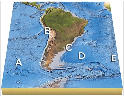
A) A and B
B) B and C
C) C and D
D) D and E
E) All of the features are on a plate boundary.
Submarine hydrothermal vents commonly are found near mid-oceanic ridges where seafloor
spreading occurs. Indicate whether the statement is true or false.
The Geographical arrangement of things on earth is called
a. spatial organization or distribution. b. environmental expansion. c. environmental complexity. d. cultural landscape. e. none of the above.