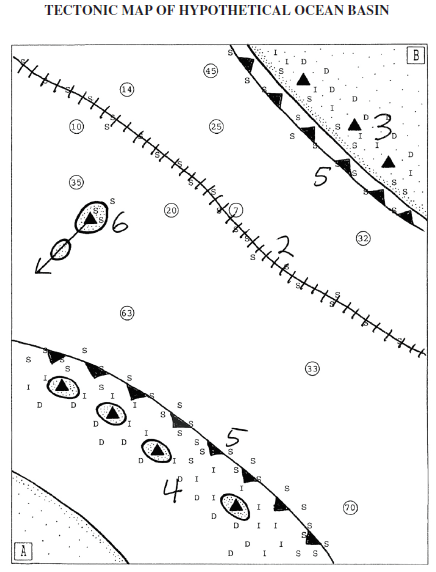
What evidence shown on the map indicates that this type of boundary is present?
After drawing in the plate boundaries using the appropriate symbols on the tectonic map below, answer the question above. When asked to cite evidence to support your answers, only cite evidence that you can see on this map.
Scale: 1 cm = 300 km 11 inch = 500 miles2
Shallow- to deep-focus earthquakes; volcanic islands.
You might also like to view...
Annual temperature ranges are high (large) throughout the D climate zones?
A. True B. False
?A nonnative species that has been introduced to the United States with positive results is corn.
Answer the following statement true (T) or false (F)
Why do different regions receive different amounts of precipitation?
What will be an ideal response?
Wetlands in the United States ________.
a. have increased due to natural causes, such as floods and hurricanes b. have increased due to human development c. have decreased due to human development d. have stayed about the same over the past 40 years e. have decreased due to natural causes, such as floods and hurricanes