How do maps communicate geographic information?
What will be an ideal response?
Answer: Maps provide a two dimensional simplified representation of features found on the earth. As a result, geographic information that is difficult to recognize when standing on the Earth often becomes apparent through the use of maps.
You might also like to view...
Identify the plate boundary that is most commonly associated with each of the three types of differential stresses
What will be an ideal response?
The first priority of integrated waste management is
a. recycling materials b. using biodegradable material c. creating more durable products d. reducing the amount of materials used e. Both c and d
What types of rocks would be most common in the small volcano in this photograph?
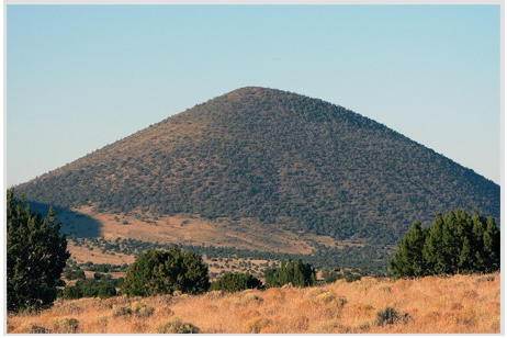
A) Scoria and other vesicular basalt
B) Basalt mostly formed in lava flows
C) Felsic and intermediate lava flows
D) Welded tuff and tephra
E) None of these are correct.
Blue northers
A) involve mP air. B) involve mT air. C) cause severe thunderstorms. D) are most frequent in late spring and early summer. E) none of the above