Is this soil more likely to have developed in a fairly flat area or on a steep slope? How do you know?
The following questions are based on Figure 27-3, the photograph of a soil profile. You may view this image in color by going to the Lab Manual website at www.MasteringGeography .com, or by scanning the QR code for this exercise. The depth scale is in inches.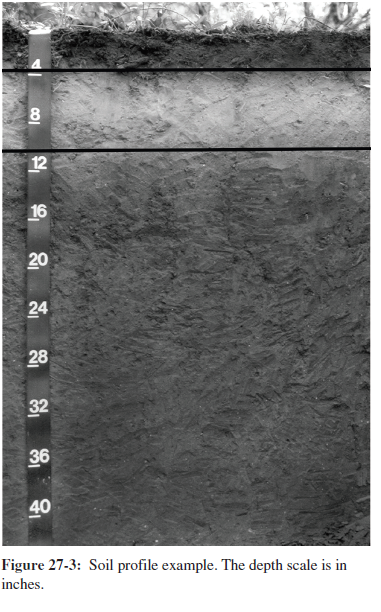
What will be an ideal response?
Fairly flat area. Deep soil development; lack of visible C or R horizon.
You might also like to view...
What is the main problem with the amount of carbon dioxide we have added to the atmosphere over the last several decades?
A. The amount released has overwhelmed the natural removal processes. B. Significant amounts of it have been absorbed by the oceans resulting in lower than expected sea levels. C. The temperature of the atmosphere is predicted to fall sharply in the coming decades. D. It has stimulated the growth of trees in rainforests around the world.
The address matching process consists of the preprocessing, matching, and plotting phases. Explain briefly what is accomplished in each phase?
What will be an ideal response?
Which of the following coordinate systems is treated as a predefined coordinate system in ArcGIS?
A. STP (State Plane) B. IDTM (Idaho Transverse Mercator) C. UTM (Universal Transverse Mercator) D. all of these are correct E. Both UTM and STP
Weathering is not influenced by vegetation
Indicate whether the statement is true or false