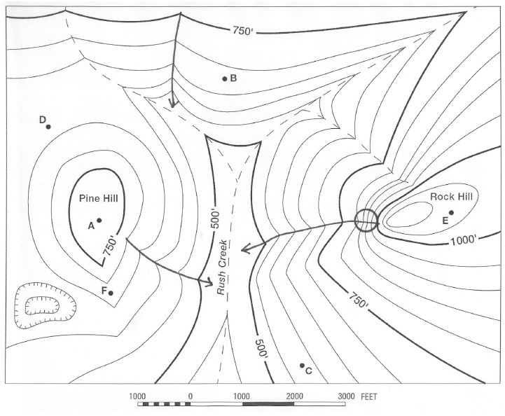
What is the elevation of Point A?
The question is based on this contour line map with elevations shown in feet.
• North is to the top of the map.
• Streams are shown with dashed lines.
• A graphic scale for measuring horizontal distances is shown below the map.
• Estimate elevations between contour lines to the nearest half-contour interval; assume that the top of a
hill is one-half-contour interval higher than the highest contour line shown.

What will be an ideal response?
775 feet
You might also like to view...
What are the three types of relative motion at boundaries of tectonic plates?
What will be an ideal response?
What do many deep water organisms use for feeding and the attraction of mates?
A) Keen eyesight B) Bioluminescence C) Sense of smell D) Electrical impulses
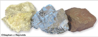
What mineral property is illustrated by this image?
A. crystal form B. luster C. cleavage D. color
What is the dominant biome and climate type of Australia?
a. humid continental b. Mediterranean c. tropical d. oceanic e. desert