What is the length of this topographic profile in miles? in kilometers?
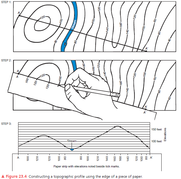
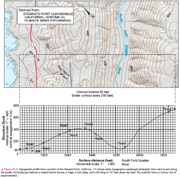
A second example of a vertical profile is in Figure 23.6. Using the same procedure as you did on the previous assignment, construct a topographic profile. Label the South Fork of the Gualala River (see Figure 23.4, Step 3), the bench mark at 112 feet, and various road crossings on your profile. The coastline forms a contour line of equal elevation—sea level. Note the change in contour interval and scale from that of Figure 23.5. Use Figure 23.6 to answer further questions about preparing a topographic profile.
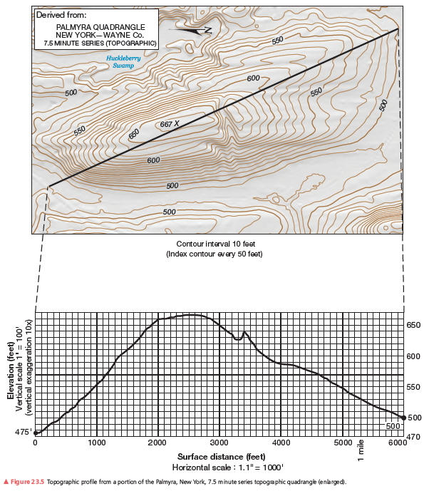
1.625 mi; 2.6 km.
You might also like to view...
A principal practice of sustainable agriculture is
A) sensitive land management. B) limited use of chemicals. C) better integration of crops and livestock. D) use of pesticide-resistant seed. E) All but the use of pesticide-resistant seed are principal practices.
Hypoxia, or low-oxygen conditions, is generally considered to occur when oxygen in the water drops to ________ ppm.
A. 10 B. 5 C. 2 D. 15 E. 0
Because of geography's focus on where and how things are located, and why, it is often called the _______________ discipline
Fill in the blank(s) with correct word
What distinguishes a mineral reserve from a mineral resource?
A. Politics B. Economic feasibility C. Existing technology D. Location