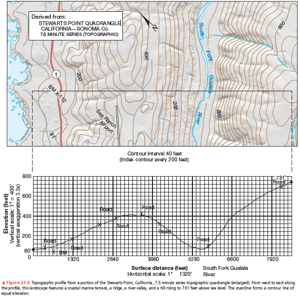
Can you physically see the shoreline when standing at the summit at 731 feet elevation? Explain.
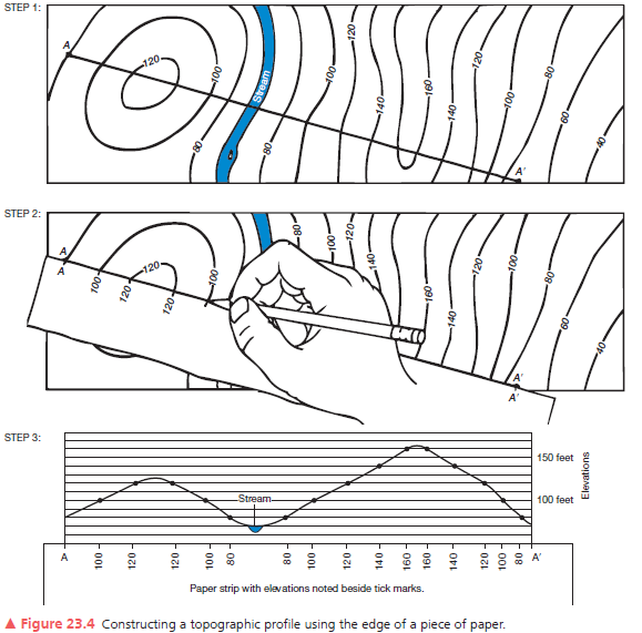
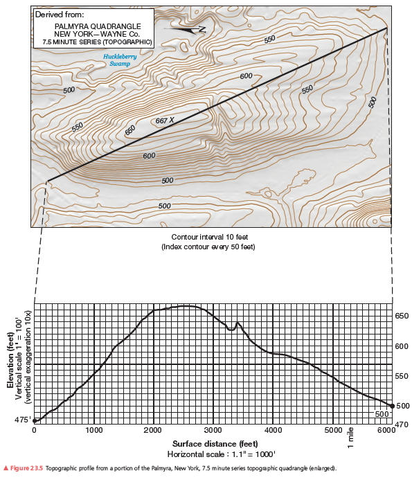
A second example of a vertical profile is in Figure 23.6. Using the same procedure as you did on the previous assignment, construct a topographic profile. Label the South Fork of the Gualala River (see Figure 23.4, Step 3), the bench mark at 112 feet, and various road crossings on your profile. The coastline forms a contour line of equal elevation—sea level. Note the change in contour interval and scale from that of Figure 23.5. Use Figure 23.6 to answer further questions about preparing a topographic profile.


No, the ridge blocks the view of the shoreline.
You might also like to view...
Population growth and fertility rates are lowest in
A) upper-income countries. B) upper- and middle-income countries. C) middle- and low-income countries. D) low-income countries.
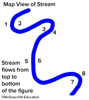
Where would be the relatively safest place to build a bridge across the stream in the accompanying figure?
A. between points 7 and 8 B. between points 3 and 4 C. between points 1 and 2 D. between points 5 and 6
The world's longest expanse of coastal dunes is located in ________
A) California B) France C) Bolivia D) Brazil E) China
What is glacial flour?
A. one of the stages of glacial ice formation B. finely ground rock that is part of a glacier’s load C. general term for all material moved by glaciers D. all sized particles that are part of a glacier’s load E. huge boulders deposited by retreating glaciers