ArcGIS offers the following three methods for defining a coordinate system: select, import, or create a coordinate system. Explain the difference between select and import a coordinate system.
What will be an ideal response?
You might also like to view...
What type of eruption is shown in this photograph?
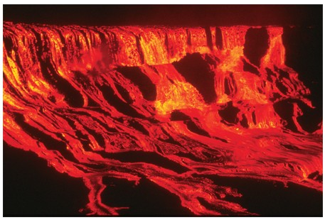
A) Lava flow
B) Lava dome
C) Lava fountain
D) Pyroclastic column
E) Pyroclastic flow
Four of the five listed outcomes are problems in National Parks. Choose the one that is the exception.
A. introduction of nonnative species B. killing of native species C. polluted air D. agricultural runoff E. deferred repairs of infrastructure
What is the most common sedimentary rock?
A) Sandstone B) Graywacke C) Shale D) Limestone
Found in Xinjiang and Mongolia, and in parts of western India, Pakistan, and Afghanistan, this climate zone is often along high mountains posing difficulties for agricultural production. These factors result in it being the Asian region's least inhabited climate zone
a. Semi arid / Steppe b. Humid subtropical c. Humid continental d. Tropical savanna e. Marine west coast