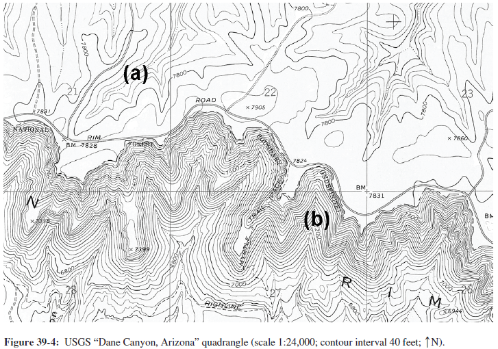
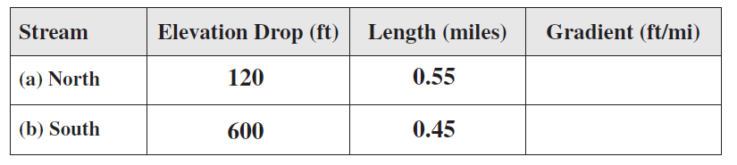
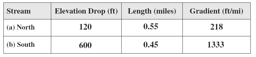
Compute the gradient of any first-order stream north of the mesa edge and the gradient of any first-order stream south of the mesa edge. On the map label the northern stream “a” and the southern stream “b.
The following questions are based on Figure 39-4, a section of USGS “Dane Canyon, Arizona” quadrangle below, showing the southern edge of the Mogollon Mesa (34°24'33"N, 111°10'52"W), formed by a nearly flat-lying layer of resistant rock (you can view this map in color by going to the Lab Manual website or by scanning the QR code for this exercise).
You might also like to view...
What factors are most important in evaluating earthquake hazards?
A. distances from plate boundaries and shorelines B. population density and number of faults C. earthquake size and depth
Currently there is extensive recycling of which of the following polymers?
A) high-density polyethylene B) polystyrene C) both a and b D) neither a nor b
The ____ climate classification is a system that concentrates on a local scale, and is most useful for water resources specialists, soil scientists, and agriculturalists
a. Köppen b. Fujita c. Penman d. Darcy e. Thornthwaite
Tidal energy comes from
A. wind. B. longshore currents. C. ocean currents. D. gravity.