How would both a Mercator and a Gnomonic map be used together in navigation?
On a globe, use a piece of string to find the shortest path between Yokohama, Japan (near Tokyo) and San Francisco. This path is a “great circle” path. Two maps are shown here, a Gnomonic (i) and a Mercator (ii).

Gnomonic used to determine the shortest route; Mercator used to plot a
series of rhumb lines to closely follow great circle route.
You might also like to view...
How can dipmeter data help identifying faults?
What will be an ideal response?
Groundwater mining is accomplished by
A) high discharge of water to streams B) thorough exploration for groundwater resources C) pumping that exceeds recharge D) very clean miners
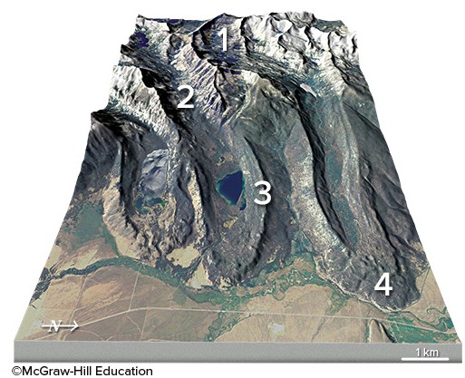
What is the feature numbered 2 in the upper left part of this figure?
A. U-shaped valley B. terminal moraine C. cirque D. lateral moraine
Roughly how many kilograms of pork do you expect to get for every 100 kilograms of feed consumed?
a. 10 b. 20 c. 100 d. 130