Which of the following is the least effective agent of erosion?
A) water
B) wind
C) ice
D) lava
Answer: B
You might also like to view...
Which of the following are the two main substances used in cloud seeding?
A. silver iodide and lead iodide B. lead iodide and dry ice C. ice crystals and flood powder D. silver iodide and dry ice
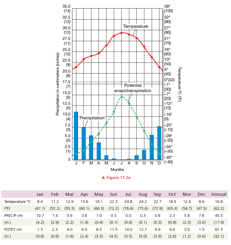
Which PRECIP regime from Figure 17.3 is this? Which diagram should you use to evaluate this climate?

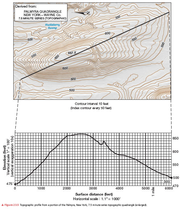
Can you see the northwest end of the runway at Sea Ranch Airport (a point just south of the profile) from the summit? Explain.
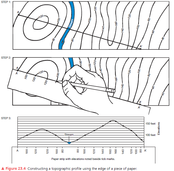
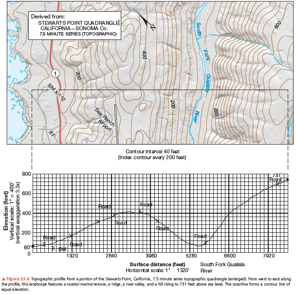
A second example of a vertical profile is in Figure 23.6. Using the same procedure as you did on the previous assignment, construct a topographic profile. Label the South Fork of the Gualala River (see Figure 23.4, Step 3), the bench mark at 112 feet, and various road crossings on your profile. The coastline forms a contour line of equal elevation—sea level. Note the change in contour interval and scale from that of Figure 23.5. Use Figure 23.6 to answer further questions about preparing a topographic profile.


Which of the following represents a resilience mechanism?
A) Crown fires resulting from many years of fire suppression B) The emergence of a meadow in a recently burned forest C) Soil erosion resulting from burned soil washing away from a forest floor D) Burned trees accumulating on a forest floor after a fire