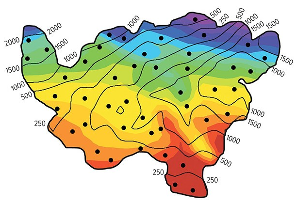
In classifying the climate of this imaginary country, the wettest and coolest areas are in the
Colors on this map of an imaginary country represent mean annual temperatures (reds above 28 degrees Celsius, blue and purple below 0 degrees Celsius).

A) northeast.
B) southeast.
C) southwest.
A) northeast.
You might also like to view...
What is the difference between numerical dates and relative dates?
A bag of groceries has a mass of 10 kg and a weight of about
A) 1 N. B) 10 N. C) 100 N. D) 1000 N. E) more than 1000 N.
To reduce exposure to damage from debris flows, buildings and streets should be built perpendicular to the downslope direction of flow
a. True b. False
Which term is used to describe the conversion of natural resources into goods and services in addition to the ongoing trade of such goods and services?
a. Economy b. nongovernment organization c. Ecosystem d. Calculator