What is the relief (elevation difference between the highest and lowest points, in a local landscape) in the river valley along southwest slopes? Along the northeast slopes?
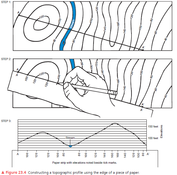
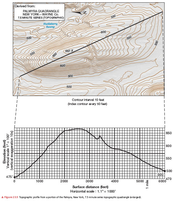
A second example of a vertical profile is in Figure 23.6. Using the same procedure as you did on the previous assignment, construct a topographic profile. Label the South Fork of the Gualala River (see Figure 23.4, Step 3), the bench mark at 112 feet, and various road crossings on your profile. The coastline forms a contour line of equal elevation—sea level. Note the change in contour interval and scale from that of Figure 23.5. Use Figure 23.6 to answer further questions about preparing a topographic profile.
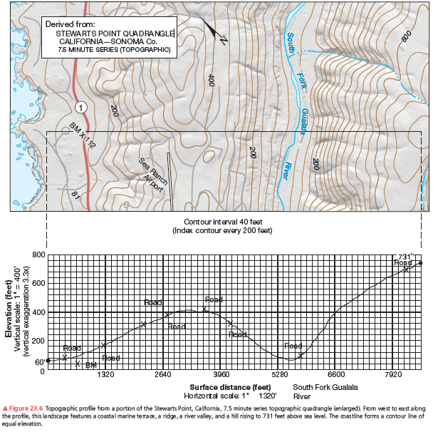
280 ft (809 to 3609) on southwest side; 600 ft (809 to 6809) on northeast side.
You might also like to view...
Normal sea level pressure has a standard value of 1013.2 mb (29.92 in. of Hg)
Indicate whether the statement is true or false
Land heats and cools more rapidly than the ocean because of its
A. lower specific heat when compared to the ocean. B. great potential for latent heat on land through evaporation. C. strong mixing through soil horizons on land. D. ability for land to retain heat better than the ocean.
Squid have two long arms and ________ short arms
A) two B) four C) six D) eight E) ten
Which processes must occur in a raindrop to produce a rainbow?
a. refraction, reflection, and dispersion of sunlight b. refraction, reflection, and scattering of sunlight c. reflection, scattering, and dispersion of sunlight d. transmission, reflection, and dispersion of sunlight e. refraction, transmission, and scattering of sunlight