The type of rock shown in this photograph is
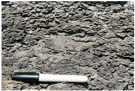
A) conglomerate.
B) breccia.
C) sandstone.
D) shale.
D) shale.
You might also like to view...
Subsidence and sinkholes
A. Leave gaps in the bedrock that then fill up with salt water B. Can, with difficulty, be reversed and the ground surface raised again C. Increase the total area of recharge zones D. Are a consequence of saltwater intrusion E. Are probably a permanent loss of an aquifer
Why are most weather data displayed in the form of a map or chart?
A) Maps display the data in their proper place, relative to other data, and allow the identification of patterns. B) Maps are easier to construct than tables. C) More data can be recorded on a map. D) Maps are easier to remember.
When ____ cools and solidifies, it becomes an igneous rock
a. limestone b. magma c. a mineral d. shale
Use your knowledge of plate boundaries to answer whether an earthquake is likely or unlikely to occur at the location of the red circle.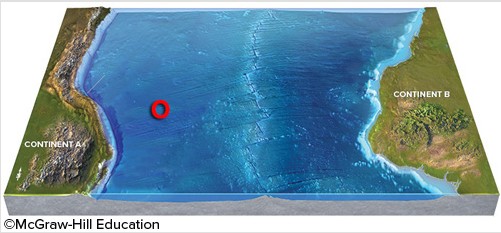
A. Unlikely B. Likely