What are some practical applications of geographical information systems (GIS) technology in range management?
What will be an ideal response?
Some practical applications of GIS technologies image management include tracking vegetation recovery after fire, determining of rangeland trend in soil loss and plant cover, determining trends in shrub encroachment, differentiation of rangeland vegetation types, and provision of information on land areas and vegetation productivity for setting stocking rates.
You might also like to view...
What is ventricular fibrillation and at what amperage passing through the body does this become a high possibility?
What will be an ideal response?
Technician A says wheel alignment angles are designed to provide improved ride qualities. Technician B says wheel alignment angles are designed to provide minimum tire tread wear and predictable directional control. Who is correct?
A. A only B. B only C. Both A and B D. Neither A nor B
Wallboard should not be installed in contact with the floor because it will _____
a. be hard to align adjoining panels b. wick up moisture and be damaged c. interfere with finish flooring installation d. make trim installation more difficult
From the definition, derive a general expression for the ? form of the DTFT of functions of the form
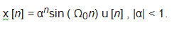
Compare with the DTFT table.