Which of the following can be used as reference data for geocoding in the United States?
A. SDTS files
B. TIGER/Line files
C. DLG files
D. SSURGO files
Answer: B
Environmental & Atmospheric Sciences
You might also like to view...
An area in primary ecological succession would be a suitable habitat for a population of hardwoods because of the availability of resources
Indicate whether the statement is true or false
Environmental & Atmospheric Sciences
At the periphery of a hurricane the air is __________, and several kilometers above the surface,
in the eye, the air is __________. a. sinking, sinking b. sinking, rising c. rising, sinking d. rising, rising
Environmental & Atmospheric Sciences
How does an ice cap compare to an ice sheet?
What will be an ideal response?
Environmental & Atmospheric Sciences
On the accompanying figure, what type of feature is located in the area of number 3?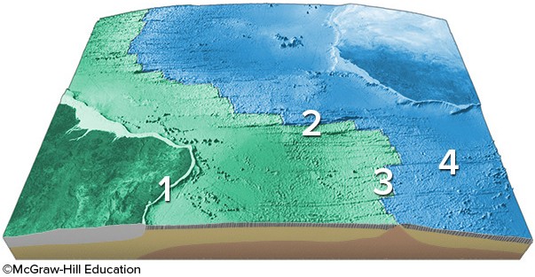
A. mid-ocean ridge B. transform fault C. fracture zone D. linear island chain
Environmental & Atmospheric Sciences