Do all of the terraces shown on your topographic profile extend, without interruption, to the southeast and northwest along this side of the island?
The following questions are based on Figure 49-8, a portion of the “San Clemente Island Central, California” quadrangle shown on the following page (scale 1:24,000; contour interval 25 feet; index contours drawn every fourth line; to view this map in color, go to the Lab Manual website or scan the QR code for this exercise), and the stereogram of San Clemente Island (Figure 49-7). The map and stereogram show a series of marine terraces on San Clemente Island in southern California (32°51"08"N, 118°29'58"W). The terraces have been incised by streams in several places.
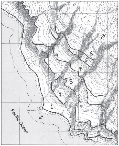
Figure 49-8: USGS “San Clemente Island Central, California” quadrangle (scale 1:24,000; contour interval 25 feet; note that the index contours on this map have been drawn every fourth line;cN)
No
You might also like to view...
Dark Matter is matter that
A. cannot be seen or felt, but can be measured through its gravitational effects. B. is Dark Energy's twin sister. C. cannot be seen, felt, or measured. D. is found within a black hole.
In the process of getting energy to power your television, which of the following stages is the most energy efficient?
A. Thermal conversion of the energy from coal in the power plant B. Burning the coal to run the power plant C. Actually powering your television set D. Transmission to your house E. Mining the coal to run the power plant
Hawaii is near an amphidromic point; therefore, its tidal range is small.
Answer the following statement true (T) or false (F)
Which of the following substances would not contribute to the eutrophication of a body of water?
A. human or animal wastes B. agricultural herbicides C. phosphates from detergents D. agricultural fertilizers