The red areas in the map below are places where
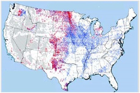
A) soil erosion due to wind is a major problem.
B) soil erosion due to water is a major problem.
C) soil is being formed faster than it is being eroded away.
D) salinization is leaving the soil ineffective for agriculture.
A) soil erosion due to wind is a major problem.
You might also like to view...
Disrupting the food webs in nature is one way that humans are creating the potential for a mass extinction.
Answer the following statement true (T) or false (F)
Why is topographic monitoring sometimes useful in forecasting a volcanic eruption?
A) A volcano sometimes swells as lava moves into the edifice. B) Volcanic eruption is more likely as an area undergoes tectonic uplift. C) Seismic activity occurs as the volcano rises. D) Topographic monitoring reveals the likelihood of lahar generation.
Suppose you are the head of an island nation with a poor, growing population and the natural resources of the island are being degraded
What kinds of policies would you initiate, and what help would you ask for to try to provide a better, sustainable future for your nation's people?
Himalayan Mountain range is formed in convergent plate boundaries
a. true b. false