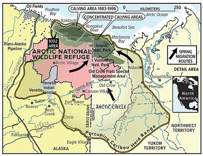
On the map below, all of the following would be considered "interpretations" except

A) spring migration routes.
B) Ivvavic National Park.
C) concentrated calving areas.
D) porcupine caribou herd range.
B) Ivvavic National Park.
You might also like to view...
The increase in atmospheric oxygen during the Proterozoic was caused by ____
a. a decrease in worldwide volcanism. b. a decrease in the size of oceans.
c. photosynthesis by cyanobacteria. d. the appearance of land plants. e. formation of banded iron formations
Bottom-up pressure from consumers demanding ____ encourages more responsible fishing practices.
A. sustainably produced seafood B. fishing subsidies C. fishing only along coasts D. seafood caught by trawlers E. farmed seafood
The Big Rock Mining company decides to build a mine shaft in South Africa that extends 3.5 km beneath Earth's surface. What approximate temperature would a person experience at the bottom of the mine shaft? (Hint: use the average accepted value for geothermal gradient.)
A. 88°C B. 25°C C. 110°C D. 75°C
We study the mantle ________. Choose the phrase that does not apply.
A. using seismic waves B. using rocks that have been naturally brought to the surface C. by drilling directly into it D. using geophysics E. using numeric models