What does a map's scale tell us? List two ways to portray map scale
What will be an ideal response?
Map scale refers to the ratio between a unit mapped and the unit on the Earth's surface; thus, we
would want to know, for example, how many inches on the Earth's surface correspond to one inch
on the map. This is a representative fraction—it is the ratio between the map and the area being
mapped. A graphic or linear scale is a visual depiction of scale, usually portrayed as a horizontal
bar. A verbal scale also refers to the area on the surface related to the area mapped, and is
indicated linguistically, such as "one inch on the map equals five miles on the Earth's surface".
You might also like to view...
Which of the following is a major source of terrigenous sediments?
A) weathering and erosion of rocks B) dissolved organic material C) dissolved nutrients D) precipitation over the open ocean
________ are typical primary consumers in a temperature deciduous forest
A) Wolves B) Bison C) Snakes D) Deer E) Shelf fungi
What are the consequences of rising sea levels?
What will be an ideal response?
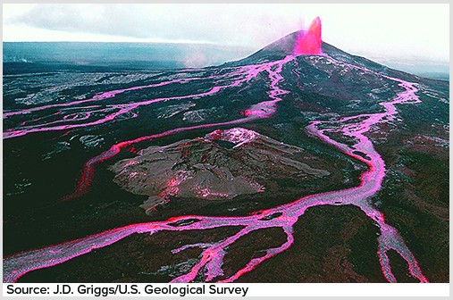
Shield volcanoes are built up primarily by relatively
A. high-viscosity dome-forming eruptions. B. explosive ash-forming eruptions. C. nonexplosive outpourings of lava.