The arrows drawn perpendicularly to the contour lines on the contour map shown indicate the direction of the groundwater flow. In this example the groundwater is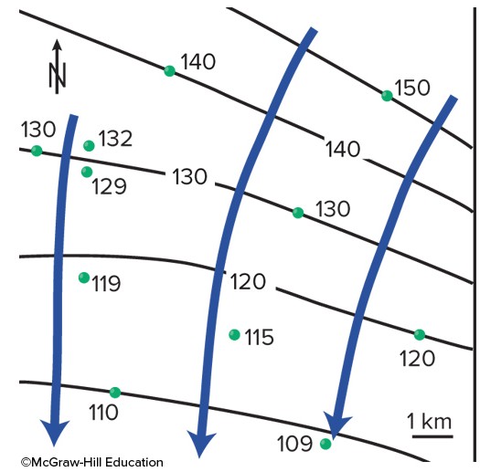
A. flowing down the slope of the water table from higher contours to lower ones.
B. flowing parallel to the slope of the water table from lower contours to higher contours.
C. flowing up the slope of the water table from lower contours to higher contours.
Answer: A
You might also like to view...
The difference in elevation between high and low points in a region is called ____
A)relief B)relief angle C)angle of declivity D)slope E)slope angle
Glacial ice forms more quickly in polar environments than in midlatitude, alpine environments
Indicate whether the statement is true or false
Why did periods of glacial advance in higher latitudes of the Northern Hemisphere tend to occur with cooler summers, but not necessarily with cooler winters??
What will be the ideal response?
What describes a change in wave direction as waves approach a headland concentrating energy there?
A. refraction B. erosion C. oscillation D. translation E. reflection