In Maryland, soil preservationists produced a new composite map by combining in their GIS
A) soil quality, environmental, and economic maps.
B) maps on soil quality and proximity to market.
C) dry harvest climate, wet harvest climate, climate change, and soil maps.
D) maps on habitat for endangered species.
E) soil quality, environmental, and political maps.
Answer: A
You might also like to view...
Recharge of groundwater
A. is slow, so that nearly all ground water has been underground millions of years. B. varies according to the geology and climate of the region and so groundwater may have been underground a few years (Karst regions) to 10,000 years or more (southwestern USA). C. is fast, so that ground water supplies are generally plentiful and consist of water that has been underground for only a few years. D. is unpredictable.
The boundaries separating legislative districts within the United States and other countries are redrawn periodically to ensure that each district has approximately the same population
Indicate whether the statement is true or false.
Of the following planets, which has the most massive atmosphere?
A) Mercury B) Venus C) Earth D) Mars
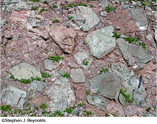
The type of rock shown in this photograph is
A. shale. B. breccia. C. sandstone. D. conglomerate.