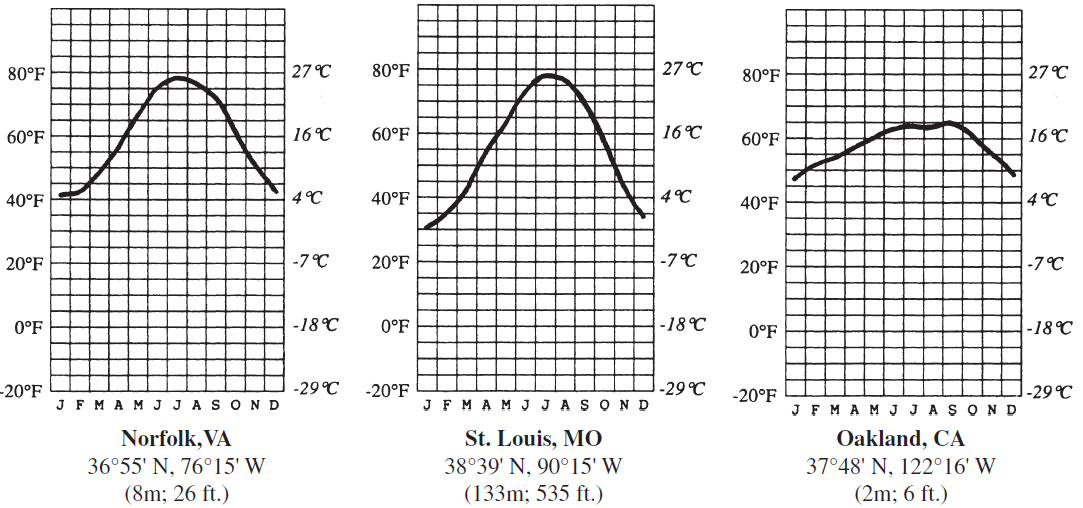
Why does St. Louis have colder winters than Norfolk?
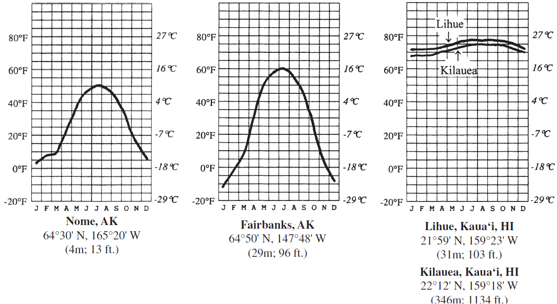
Six charts showing the average monthly temperature (in °C and °F) for seven U.S. cities are provided (the first letter of each month of the year is shown along the bottom of the charts). For each of the cities, the latitude and longitude, as well as the elevation, are provided.


Answer the question by comparing the temperature charts. In your answers, consider the one temperature control factor that is most responsible for the patterns shown (choose from latitude, land–water contrasts, wind patterns, or altitude). You may use the same answer for more than one question. You should locate each of the cities on a world map before trying to answer the question. If altitude is the main factor cited, calculate the expected temperature difference between the two cities based on the average lapse rate.
Land-water contrasts: Norfolk is coastal and so temperatures are moderated.
You might also like to view...
The doldrums are located in the Intertropical Convergence Zone, near the north pole.
Indicate whether the statement is true or false.
In the 1989 Loma Prieta quake, the Marina District building collapses were extensive, and numerous destructive fires broke out, due to all but which one of the following?
A. Widespread looting and arson B. Amplified shaking C. Deformation and liquefaction of artificial-fill foundations D. Soft first-story construction that led to building collapses
Looking at the map (11.2), in what state or province are the northernmost dunes in the Great Plains located?
A) Saskatchewan B) Alberta C) Manitoba D) Montana
Which of the following is an example of a product found in a "throwaway society," such as the United States?
A. paper napkins B. reusable cloth diapers C. reusable razor blades D. fine silverware