Continental glaciers ____
a. flow plastically
b. move from thinner to thicker ice
c. move from warmer to cooler regions
d. do not flow
a
You might also like to view...
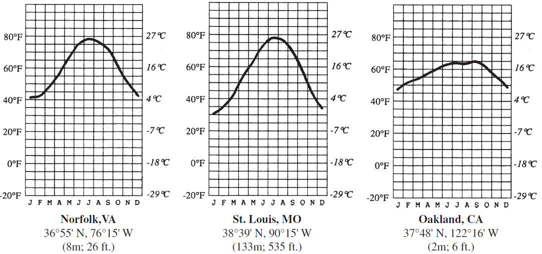
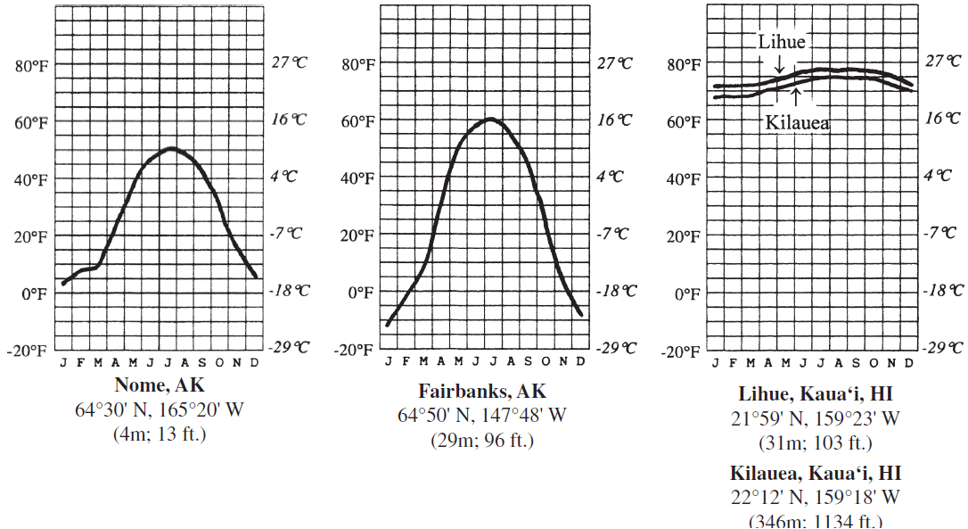
Which factor primarily explains the difference in temperature patterns between Fairbanks and St. Louis?
Six charts showing the average monthly temperature (in °C and °F) for seven U.S. cities are provided (the first letter of each month of the year is shown along the bottom of the charts). For each of the cities, the latitude and longitude, as well as the elevation, are provided.


Answer the question by comparing the temperature charts. In your answers, consider the one temperature control factor that is most responsible for the patterns shown (choose from latitude, land–water contrasts, wind patterns, or altitude). You may use the same answer for more than one question. You should locate each of the cities on a world map before trying to answer the question. If altitude is the main factor cited, calculate the expected temperature difference between the two cities based on the average lapse rate.
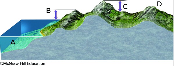
Which letter on the accompanying figure indicates the amount of topographic relief?
A. A B. B C. C D. D
Discuss the potential for geopolitical devolution in Europe today. What examples illustrate the possible changes brought by a decentralization of power away from a central authority?
What will be an ideal response?
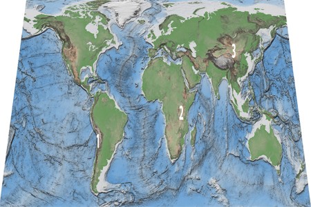
Which of these regions is high because of subduction of an oceanic plate?
A. 3, Tibet B. 2, East Africa C. 1, Andes of South America D. None of these.