On a surface weather map during the month of July, which of the following types of pressure systems may be found over the Canadian Prairies?
A. thermal low
B. Aleutian low
C. Pacific high
D. monsoon low
Answer: A
You might also like to view...
The bob of a simple pendulum has its maximum potential energy at the
A. bottom of its swing. B. same at all points along its path of swing. C. midpoint between top and bottom of its swing. D. top of its swing.
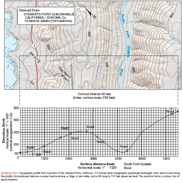
Can you physically see the shoreline when standing at the summit at 731 feet elevation? Explain.
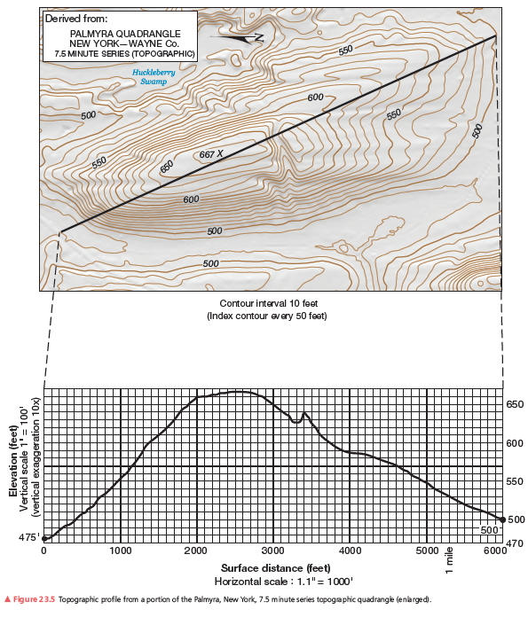
A second example of a vertical profile is in Figure 23.6. Using the same procedure as you did on the previous assignment, construct a topographic profile. Label the South Fork of the Gualala River (see Figure 23.4, Step 3), the bench mark at 112 feet, and various road crossings on your profile. The coastline forms a contour line of equal elevation—sea level. Note the change in contour interval and scale from that of Figure 23.5. Use Figure 23.6 to answer further questions about preparing a topographic profile.
What are the main components of urban air pollution?
What will be an ideal response?
All coastal classification systems are based on plate tectonics
Indicate whether the statement is true or false