A(n)________ is a homogeneous volume of air defined based on its temperature, and moisture characteristics
A) front B) cyclone C) air mass D) parcel
C
You might also like to view...
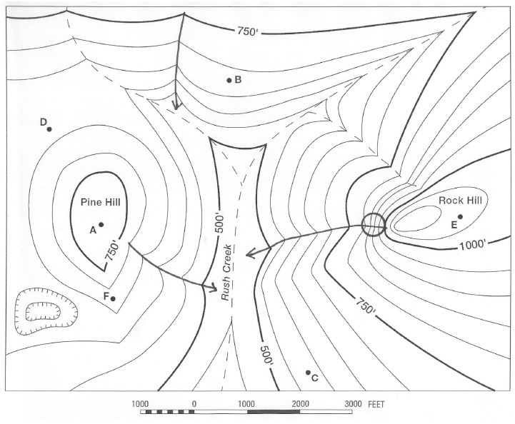
Where is the lowest elevation shown in this landscape? (It may not be a location marked with a letter.)
The question is based on this contour line map with elevations shown in feet.
• North is to the top of the map.
• Streams are shown with dashed lines.
• A graphic scale for measuring horizontal distances is shown below the map.
• Estimate elevations between contour lines to the nearest half-contour interval; assume that the top of a
hill is one-half-contour interval higher than the highest contour line shown.
What will be an ideal response?
Radar gathers information about precipitation in clouds by measuring the ____
A) energy emitted by the precipitation particles B) absorption characteristics of falling precipitation C) amount of energy reflected back to a transmitter D) amount of sunlight scattered off the precipitation
Which pressure belt is associated with the equator?
What will be an ideal response?
On a geologic map, a symbol that looks like a cross indicates ________.
A. branching beds B. overturned beds C. intersecting beds D. horizontal beds E. vertical beds