In which global reservoir does water reside for the
longest time? What will be an ideal response?
Deep groundwater or ocean.
You might also like to view...
Light when entering a pond at an angle bends
A. away from the normal. B. toward the normal. C. same either way D. none of the above
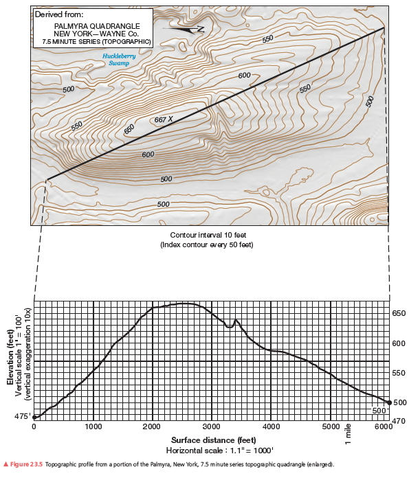
What is the length of this topographic profile in miles? in kilometers?
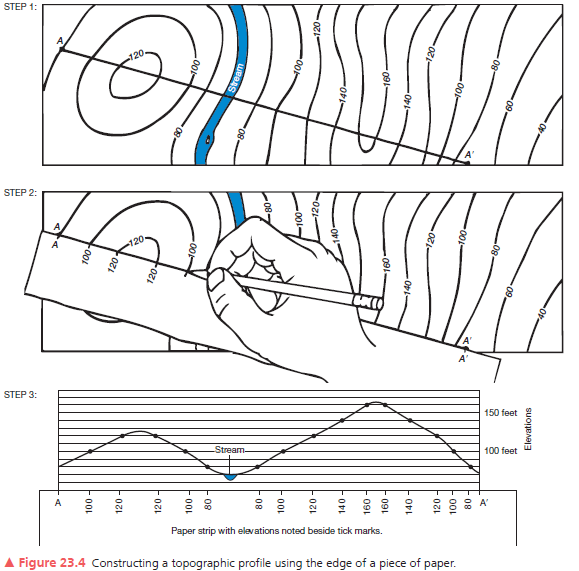
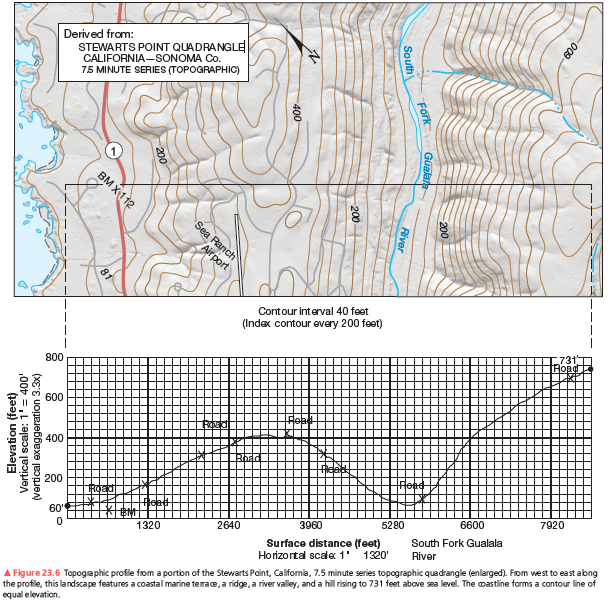
A second example of a vertical profile is in Figure 23.6. Using the same procedure as you did on the previous assignment, construct a topographic profile. Label the South Fork of the Gualala River (see Figure 23.4, Step 3), the bench mark at 112 feet, and various road crossings on your profile. The coastline forms a contour line of equal elevation—sea level. Note the change in contour interval and scale from that of Figure 23.5. Use Figure 23.6 to answer further questions about preparing a topographic profile.
The hydrologic cycle is driven primarily by ____.
A. solar energy B. lunar tides C. solar tides D. mechanical energy E. chemical energy
Where could you generally find rich soils with the potential to be transformed into productive agricultural lands in arid regions?
a. mesas b. buttes c. playas d. washes e. piedmont alluvial plains